Day 4 Askham Fell
Thursday 2nd August
Details for Askham Fell.
Location
Nearest town: Askham
Grid Ref: NY505233
Postcode: CA10 2PG
Latitude: 54.60562
Longitude: -2.75858
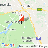
Google Map (aerial)
Bing Map (OS)
OpenStreetMap
Results links
Results
Winsplits
Routegadget
Splitsbrowser
BOF Results
Organising Club
Border Liners
Officials
Planner ; Andy Lewsley
Organisers ; Anita Laird, Raymond Wren, Christine Goulding, Isabel Berry
Controller ; Andy Quickfall (SROC)
Photos
If you want to see photos of the various days, one place to see them is the collection put together by Laurence Johnson
Parking
Whitby Stead Farm, Askham, GR NY505233 Postcode CA10 2PG, Signed from Askham. Recommended route from M6 J40 via A66 and A6 to Eamont Bridge, right in Eamont Bridge onto B5320, then left at Yanwath signed to Askham. Please drive slowly and considerately in Askham village.
Assembly
Adjacent to parking. Limited space for club tents between last control and finish.
Start directions and climb etc.
1km, 60m climb. A mix of grassy fields and some woodland with a few rough patches.
Finish
200m back to assembly.
Map
There is widespread bracken; only that which we think will slow you is mapped. You should not use the edge of the bracken screen to navigate.
Courses visiting the most northerly part of the map may encounter some low gorse, generally easily avoided and not mapped.
Toward the end of all senior courses competitors will encounter areas of gorse and thistles. Gorse is mapped as fight, thistles are shown as good visibility slow run, low gorse in this area only is shown as good visibility difficult to run.
Shooting butts (circular hides) shown with a black circle ISOM 530. Prominent posts shown with black cross ISOM 531.
Paths: These are mapped, but new paths and quad bike tracks are continually appearing, these will not be on the map.
Courses 1 - 9 & 13: A3 maps. Courses 10, 11, 14 - 17: A4 maps.
Terrain
Askham Common is a large open area. Underlying limestone means there is little surface water and lots of sizeable sink holes, pits and depressions. Where there are marshes, these can be hard going, particularly if very wet. Surface vegetation varies from smooth grass to runnable tussocks and low heather. There is bracken across the area – see mapping notes. The area is widely used by the public and has many paths.
Safety Information
The area does not have a distinct boundary to the west. Safety bearing is east to the intake walls and will be printed on the map.
Other Information
There is no string course on Day 4. There are a number of local businesses in Askham, including a heated outdoor swimming pool and competitors are encouraged to support these while in the beautiful Lowther valley for the event. Lowther Castle grounds along with Askham Hall are also nearby.
Categorised under: Day 4